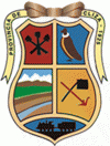
Cliza (Cliza)
 |
It is believed that in the pre-columbine era, men from Cliza were known as "Sapanas" (quechua for braid), given that they wore their hair in a long braid. The Sapana men used to live in Sach'amoqo, abundant of green pastures, next to crystal clear springs, under the bluest sky. Manco Kapac's descendants farmed this land and practiced the three Inca commands: Ama quella (Do not be lazy), Ama llulla (Do not lie), and Ama sua (Do not steal), as well as the ayni.
When the Spaniards arrived, the name Sach'amoqo was changed to Valle de Elisa because, it is said that when they took over the Tawantinsuyu and asked the Quechuas for the sapanas tribe's name, they answered "It's the tribe of the Lisas (Quechua for brave, surly)". The name was then changed to Valle de Cliza when the Spanish crown offered the town's lands as a gift to Pedro Ximenes de Vargas in 1595. When Pedro Ximenes de Vargas died, his daughter Francisa Vargas inherited the lands, who upon her death, left in her will that the lands go to the Santa Clara Monastery. This event resulted in the final formation of el Valle de Cliza.
In September 21st of 1912, Dr. Eliodoro Villazon Montano founded Cliza as a province by law. Later in 1945, Lieutenant Colonel Gualberto Villarroel modified the title of Provincia Cliza for Provincia German Jordan in honor of his son, illustrious, fallen soldier of the Chaco War.
Map - Cliza (Cliza)
Map
Country - Bolivia
 |
 |
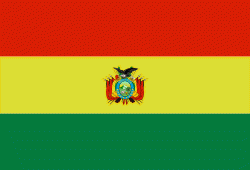
| Flag of Bolivia | |
The sovereign state of Bolivia is a constitutionally unitary state, divided into nine departments. Its geography varies from the peaks of the Andes in the West, to the Eastern Lowlands, situated within the Amazon basin. One-third of the country is within the Andean mountain range. With 1098581 km2 of area, Bolivia is the fifth largest country in South America, after Brazil, Argentina, Peru, and Colombia (and alongside Paraguay, one of the only two landlocked countries in the Americas), the 27th largest in the world, the largest landlocked country in the Southern Hemisphere, and the world's seventh largest landlocked country, after Kazakhstan, Mongolia, Chad, Niger, Mali, and Ethiopia.
Currency / Language
| ISO | Currency | Symbol | Significant figures |
|---|---|---|---|
| BOB | Boliviano | Bs | 2 |
| ISO | Language |
|---|---|
| AY | Aymara language |
| QU | Quechua language |
| ES | Spanish language |


